
Search a Mason County Parcel
Every Mason County property search comes down to one move: turning your best clue into a parcel number. The WV Property Viewer E-911 mode handles precise street addresses. The assessor IAS search handles owner names, street names, full parcel IDs, or separate district, map, parcel, and suffix parts. When a result matches the land, take its ID and legal description to the County Clerk if a recorded deed or lien is the real question. The assessor and GIS tools find the parcel. The recorded instrument proves the conveyance.
A rural address that comes up empty should not end the effort. E-911 matching rejects rural routes and PO boxes, and IAS address strings run incomplete. Search the street name in IAS instead. Try a shorter owner-name form. Then compare the map location against the situs and mailing fields. Each result hands you a better key for the next office, and the search grows sharper at every step.
- Enter the street, city, and WV in E-911 when the street number is known. If that fails, select Mason County in IAS and try the street name.
- Open the matching parcel and write down the GIS ID, owner, situs, mailing address, acreage, and legal description.
- Use the owner spelling, parcel ID, deed book, and page to ask the County Clerk for the latest recorded deed.
- Check the assessor values and tax fields separately, then view the same parcel in the WV Property Viewer.
- Ask the record custodian about a certified copy, the fee, and any older book or index that is not online.
Mason County Address Search Paths
Statewide tools split address work into two modes. E-911 is the stronger test for a full situs address. However, it is a matching service, not a general mailing-address finder. A rural route, a box number, or a street string that differs from the emergency-address record may return nothing at all. IAS searches assessor property addresses. It runs incomplete too, so the viewer help suggests a street-name search when a full address fails.
When a result appears, compare the map pin and physical address before trusting it as the right home. A mailing address can belong to an owner living elsewhere. Around Mason edges, the postal city, the municipal boundary, the tax district, the E-911 response area, and the legal parcel are not interchangeable things. Point Pleasant, New Haven, and Mason are the county's three largest incorporated places. Yet their property records still flow through the county assessor and County Clerk.
Use the WV Property Viewer for address matching and map context, then switch to the assessment form for detailed assessor attributes. That split saves time when an address search fails. The parcel may still sit in the system under a street name or owner.
Fields in the Mason County Search
The assessment application separates common lookups from appraisal filters and advanced options. The fields documented on the Mason County assessor search form fall into those groups. Not every box needs filling. Start with one strong key. Then narrow a crowded result using district, street, class, acreage, or sale information.
| Field or mode | Type | Use and format |
|---|---|---|
| County | Dropdown | Select Mason to run a county search. |
| District | Dropdown or text | Optional tax-district selection. |
| Full Parcel ID | Text | Enter the full IAS identifier and preserve leading zeroes. |
| Owner Name | Text | Partial name is supported; viewer guidance says last name first. |
| Map Number | Text | Search the map component separately. |
| Parcel | Text | Search the parcel component separately. |
| Sub-Parcel | Text | Search the suffix/sub-parcel component. |
| Street Name | Text | Use the street when IAS address data is incomplete. |
| Property Class | Dropdown | Options depend on Mason's selected county/application. |
| Tax Class | Dropdown | Optional classification filter. |
| Land Use | Dropdown | Optional land-use filter. |
| Min/Max Land Appr | Numeric | Filter by land appraisal. |
| Min/Max Building Appr | Numeric | Filter by building appraisal. |
| Min/Max Total Appr | Numeric | Filter by total appraisal. |
| Min/Max Calculated Acres | Numeric | Filter the calculated acreage field. |
| Min/Max Price | Numeric | Filter reported sale price, not the deed image. |
| Min/Max Deeded Acres | Numeric | Filter the acreage attributed to deed data. |
| Sale From / Sale Through | Date | Set a sale-date range. |
| Flood Hazard | Dropdown | Advanced search filter. |
| Mailing Address | Text | Search owner correspondence address, distinct from situs. |
| Deed Book | Text | Cross-reference a County Clerk instrument. |
| Page | Text | Use with deed book as the record reference. |
| Legal Description | Text | Search the parcel's written land description. |
| Building Year Min/Max | Numeric | Filter improvement age. |
| Primary Structures Min/Max | Numeric | Filter structure counts. |
| Building Area Min/Max | Numeric | Filter improvement area. |
| Secondary Structures Min/Max | Numeric | Filter accessory structure counts. |
| Lines per page | Numeric or dropdown | Change result display size. |
| Display legal description | Checkbox | Add the description to result output. |
| Display GIS parcel ID | Checkbox | Add the GIS parcel identifier to results. |
| Basic / Appraisal-Sales / Advanced / Prior Ownership | Mode tabs | Choose fields by question; Prior Ownership depth is not verified. |
| Hide / Search / Reset | Controls | Show or submit the selected query, or clear its filters. |
The assessor runs a market-value assessment each year and visits all real estate at least once every three years. That calendar does not promise a same-day owner update after a closing. For corrections to the IAS record, contact the County Assessor.
Address: best when you have a complete situs street number; the E-911 mode does not accept rural routes or PO boxes.
Owner: search a partial last name first, then narrow by street, district, or map because one name can match several parcels.
Parcel ID: most precise when known; retain district, map, parcel, and suffix as returned.
Mason County Search Form
The WV Assessment Search displays how the state form groups parcel, owner, street, appraisal, sales, and legal-description fields. Treat the picture as a reference to the current layout. It is not a property result for any particular owner.
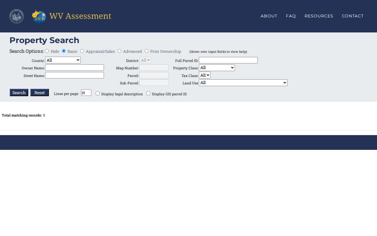
Choose a narrow search first by reading the field labels. If an owner-name result comes back broad, add the tax district or street rather than guessing at an unverified parcel number. The WV Property Viewer pairs a searchable map with parcel details and exposes the state map interface Mason County users share.
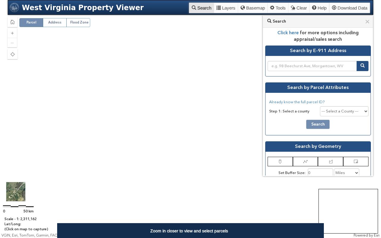
Selecting on the map helps separate parcels with similar addresses. Carry the resulting ID back to the assessor form and the County Clerk request.
What a Mason County Result Shows
A Mason County parcel result joins several clues. Each field answers a different question. The owner field carries the name in the assessor data. The physical address locates the land. The mailing address is where the owner gets mail. The parcel ID ties the result to tax maps and office records. A detailed result can add acreage, appraisal, and sale data. It may also include deed references and a legal description.
| Owner of record | Assessor owner field; the summary shows one owner even if several hold title. |
|---|---|
| Situs and mailing address | Physical parcel location and owner contact address can differ. |
| Parcel number | District, map, parcel, and suffix identify the tax-map record. |
| Appraisal fields | Land, building, and total values come from assessor data. |
| Legal description | Deed text, lot/block, acreage, easement, or adjoining calls may be shown. |
| Sale data | Reported date and price fields; check the recorded instrument for consideration. |
| Deed reference | Book and page help locate the County Clerk instrument. |
| GIS map | Parcel geometry at close zoom, for orientation rather than a survey. |
The viewer result table exports up to 1,000 rows as a CSV. A broad export does not verify an ownership history. Search summaries show one owner. The detail card may hold more than one. Joint ownership, an estate, a trust, or an LLC may matter. Read the recorded deed itself. The assessor's sale field cannot replace the deed image or its legal description either.
Read a Mason County Parcel ID
West Virginia parcel identifiers have four parts. A two-digit district comes first, then four-digit map, parcel, and suffix segments. Those leading zeroes matter. A written ID may show hyphens in a map display. An assessor form may show a continuous string instead. Preserve the exact version from your result. Dropping a zero or mixing map and parcel segments can point to a different tract.
- District
- The two-digit tax district segment.
- Map
- The four-digit map number within that district.
- Parcel and suffix
- Four digits each; the suffix distinguishes a parcel component.
- Situs
- The physical address of the land, unlike an owner's mailing address.
Older deeds often carry a lot, district, or map label. That label no longer matches the modern parcel ID. Ask the Assessor how the historic label translates into today's number. Keep both identifiers in your notes. The County Clerk's legal description then serves as the bridge that ties the two together.
When a Mason Search Fails
A blank result is not proof that the land or the record is missing. It usually means the search key needs to change. Try the street name in IAS, shorten an owner name, strip punctuation from an entity, or search the parcel's components one at a time. If the assessor still cannot place the property, call the Assessor at 304-675-2840 with the address and any old deed reference in hand. Deed-index questions go to the County Clerk at 304-675-1997, where staff can tell you whether the Record Room offers an in-house terminal, a vendor index, a book and page lookup, or a paper index for the year you need.
Inside the courthouse, the Clerk's Record Room and the Assessor handle separate duties, so know which office you need before you go. The courthouse sits at 200 Sixth Street in Point Pleasant. County offices keep hours of Monday through Friday, 8:30 a.m. to 4:30 p.m. One quick call can confirm whether a staff search or a certified copy is available before you make the trip.
For a record that is not posted online, a request under the West Virginia Freedom of Information Act should go to the office that actually holds the file. Name the address or parcel, the record type, and the date range. The office has five days to respond, not counting weekends and legal holidays. That clock is not a guarantee that an old file surfaces right away.
Mason County Ownership History
Treat the Prior Ownership tab as a lead rather than a full deed chain. The assessor application does not state how deep its online history runs. It also does not say where it cuts off. The Clerk's local deed series begins in 1804. That starting year says nothing about what you can search online. Ask the Record Room for its earliest index year. Ask whether the older books survive as paper, microfilm, or files at a public terminal.
For every link in the chain, record the grantee, grantor, and deed date. Also record the book and page or instrument number, legal description, and acreage. When the chain touches an estate, trustee, sheriff, or corporation, capture that name too. It becomes a fresh search key. A property search pins down the current parcel. Ownership history, by contrast, takes its own separate pass through the deeds and probate filings.
Choose a Mason County Search Key
Choose the search key least likely to wobble. A known parcel ID gives the tightest match. A street address works well. A rural route or PO box is not an E-911 situs, though. A person or entity name can pull up multiple parcels and multiple spellings. In Mason County, confirm any hit against the map and legal description. Ask another office for a record only after that.
| Search Key | Best For | Where It Works | Watch Out |
|---|---|---|---|
| Address | Locate one known site | E-911 for precise situs; IAS by street | Rural routes and PO boxes do not work in E-911. |
| Owner name | Find assessor parcels tied to a person or entity | IAS Owner Name; partial text | Joint owners and entity spellings can change the match. |
| Parcel number | Match a known legal parcel | Full ID or district/map/parcel/suffix | Keep leading zeroes and verify the district. |
Not a title search. A Mason County property search reports assessor and recorded data but does not guarantee clear title or locate every unrecorded interest. For a purchase, rely on a title professional and review the controlling deed and legal description.
When a search returns a long list of parcels, apply the district or street as the next filter. The state viewer caps results at 1,000 rows. Broad searches should be narrowed before any CSV export. Save the date and search mode alongside your results so a later session can reproduce the same route.